
Turn gathered data into clear action
From a single flight mission we can create survey accurate 2D orthographic maps, 3D point clouds and digital models.
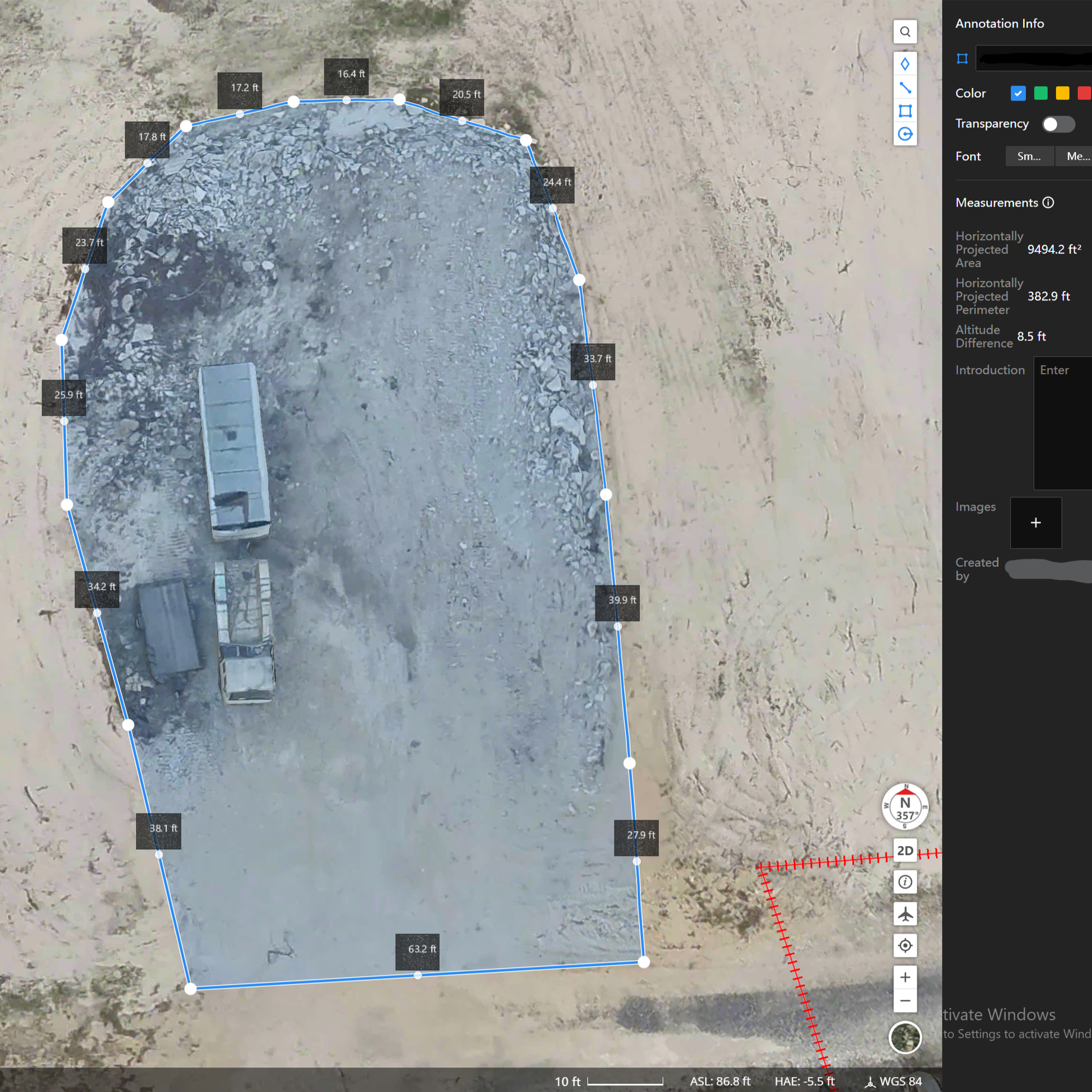
Taking accurate measurements before going into the field saves time. Overlaying real world data with digital plans catches mistakes before they happen.
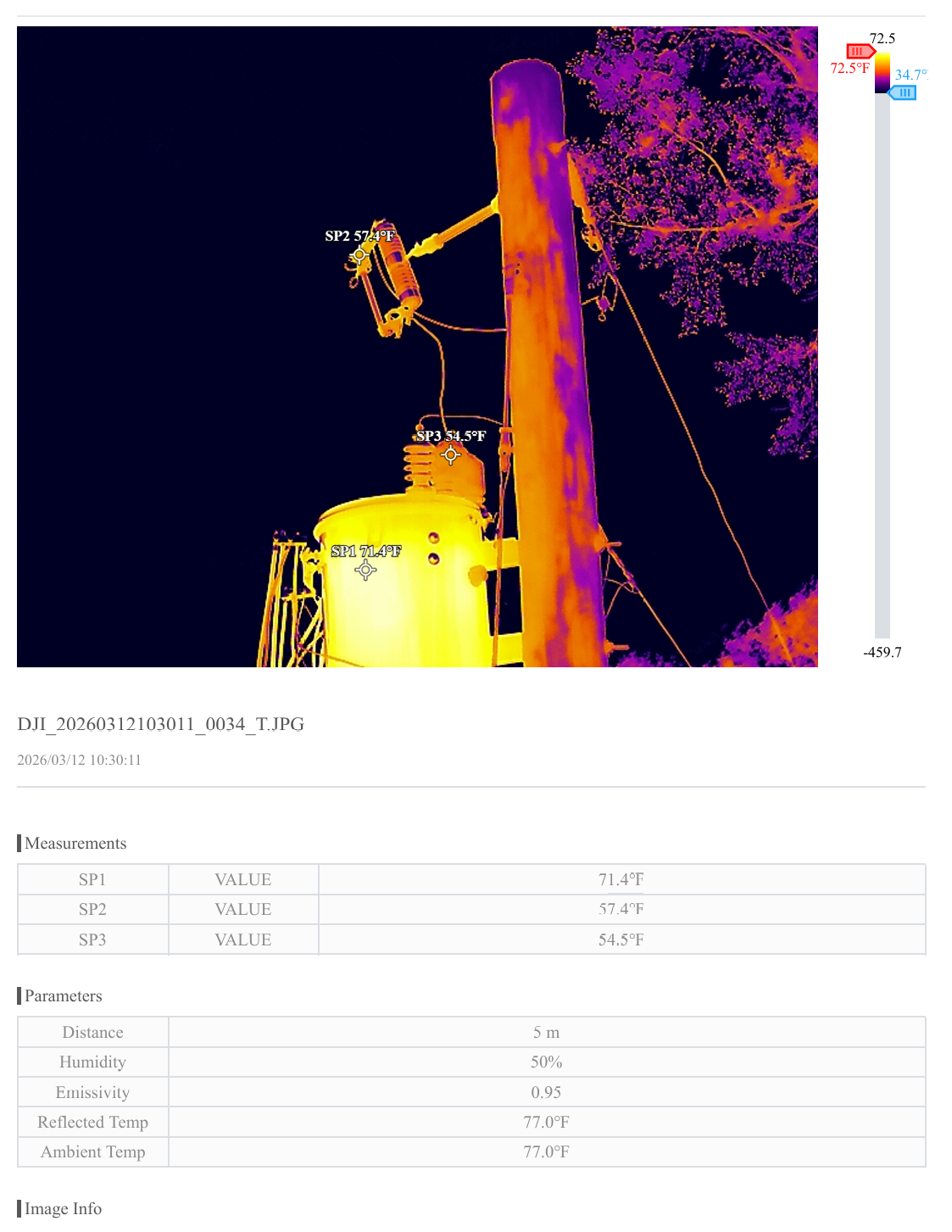
Gathering accurate temperature data on critical components can spot potential points of failure before they become a bigger problem.
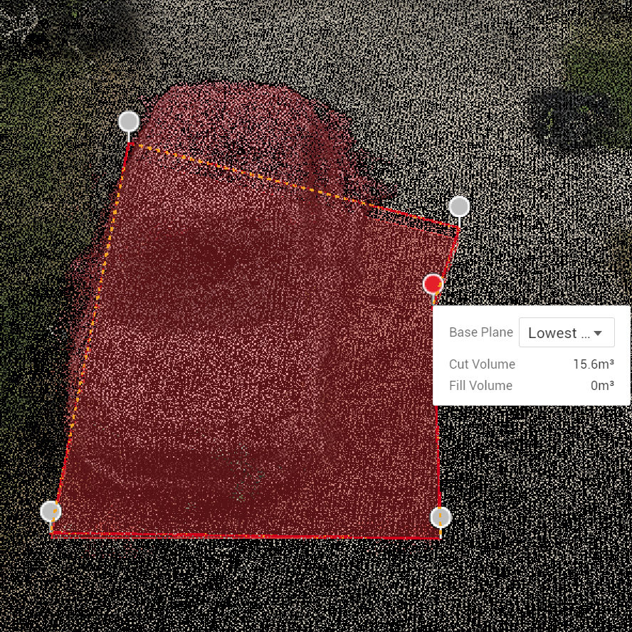
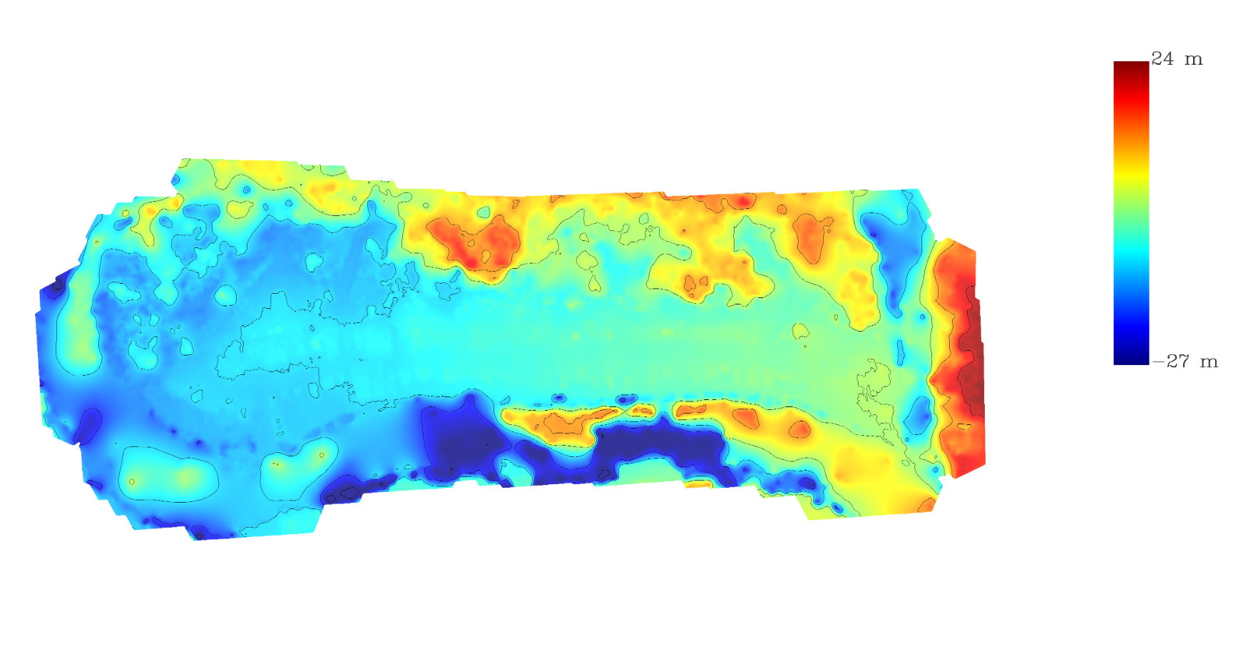
Quickly generate topographical contours of unbroken ground.
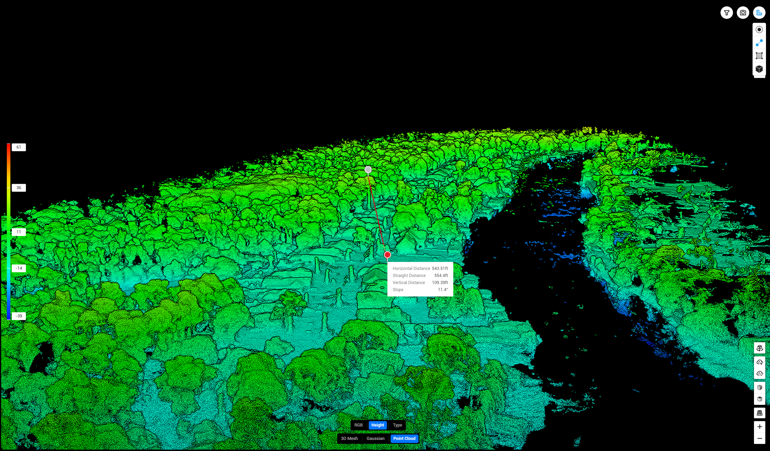
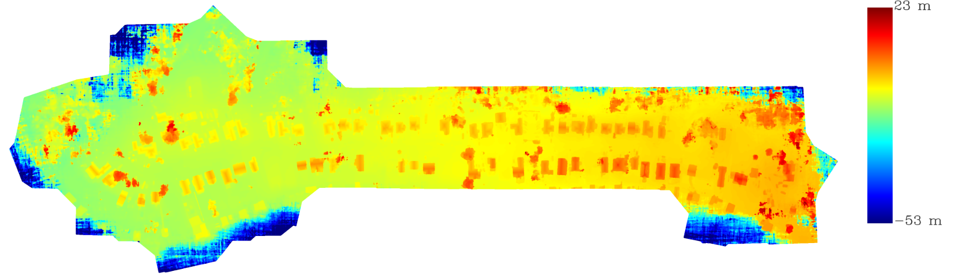
Generate Large 3D Scale Models
Our models are created with RTK equipped drones with centimeter level accuracy.
Map large areas quickly and safely.